How dark is the sky at the Kyritz-Ruppiner Heide?
When will the Milky Way be visible at the Kyritz-Ruppiner Heide in 2027?
Nights in each month when the Milky Way core stands more than 10° above the horizon for at least an hour of moonless astronomical darkness. At 53.1° north the core peaks at about 8° high, so a clear southern horizon matters. These are calculated positions of the sun, moon and Milky Way; whether a night is clear is only known closer to the date.
Can you see the northern lights at the Kyritz-Ruppiner Heide?
Has the sky over the Kyritz-Ruppiner Heide gotten brighter?
Each point is how much artificial light added to the natural brightness of the sky overhead that year: 0% is a natural sky, 100% means twice as bright. Same satellite every year; it barely sees the blue part of white LED light, so recent years probably read too dark.
Clear nights at the Kyritz-Ruppiner Heide by month
The average number of nights each month with less than 30% cloud, from NASA POWER satellite records.
Lights around the Kyritz-Ruppiner Heide seen from orbit
NASA satellite image of light at night, 2025. The rings mark distances from the Kyritz-Ruppiner Heide.
Where can you drive to the darkest sky at the Kyritz-Ruppiner Heide?
The darkest viewpoints, car parks, campsites and picnic sites you can drive to, up to about 60 km from the center of the Kyritz-Ruppiner Heide. Drive times from Wittstock, the nearest town of 5,000 people or more (13 km NW).
None of these spots can be reached by car: there are no roads to them, or only by ferry or a long hike. Use them to see where the darkest land is.
A spot closed at night, or a number that looks wrong? Let us know.
Where are the observatories near the Kyritz-Ruppiner Heide?
Observatories within 150 km, with the modeled sky at each. Older ones often sit inside towns, newer ones were built where it is dark. Many are research or club sites, so check opening times before you go.
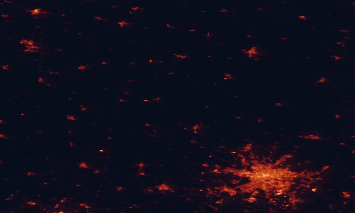
Almost black on purpose: there's next to no artificial light within this circle. This is what a dark sky looks like from orbit.
Which towns light up the the Kyritz-Ruppiner Heide horizon?
The compass shows where the glow on the horizon comes from, counting all light more than 5 km away. The table names the towns behind it, including the Kyritz-Ruppiner Heide's own outskirts.
| Source | Distance | Share |
|---|